The petroglyph boardwalk at Kaloko-Honokōhau National Historical Park reopened at the end of May after being closed since October 27, 2025 for repairs, according to Big Island Now. If that news is what's pulling you back to the park this month, you're solving for the wrong variable. The boardwalk tells you whether you can walk over the petroglyphs without stepping on them. It has nothing to say about whether the trip is worth the drive that particular morning. That decision belongs to the tide chart, and it has belonged to the tide chart since before the park had a name.
Anyone who has lived near the airport corridor for more than a season already knows Kaloko-Honokōhau exists. It sits less than five miles south of Ellison Onizuka Kona International Airport, on the ocean side of Highway 19, and it shows up on every visitor's must-see list. What doesn't show up on those lists is the difference between a walk that shows you a centuries-old engineering feat and a walk that shows you a flat gray line of rock half-submerged in chop. That difference is entirely about water level, not weather, not weekday, not how early you get there.
What Actually Reopened
The boardwalk protects the petroglyph field, carved into old lava flows that run toward the coastline. Repair crews replaced the old wood planking, and the update was framed by the park as both a preservation move and an accessibility one. Benches and a shaded structure were still slated to follow, so if you visited in June and found nowhere to sit, that part of the project may have landed by now.
None of that changes what the boardwalk actually does. It routes foot traffic around carved stone that's easy to damage and impossible to replace. It does not affect the fishponds, the fish trap, or the beach, which sit on a separate loop entirely and run on their own clock.
The Wall Only Tells the Truth at Low Tide
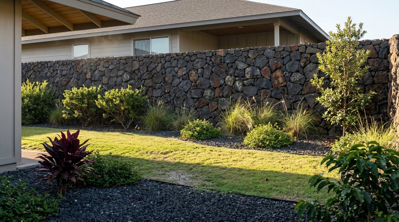
Kaloko Fishpond holds the largest kuapā, or fishpond wall, in the state, a dry-stacked lava rock seawall now more than 800 feet long and roughly 40 feet wide. The original wall, about 250 yards of it, stood 30 feet wide and 6 feet tall until storms destroyed it in the 1950s. What you see today is the product of a long reconstruction effort that referenced archaeological records and worked with Hawaiian elders to rebuild the wall the way it was originally built, using a makaha, or sluice gate, and an angled face designed to diffuse wave energy while still letting water pass through the porous rock. It is also, at high tide, nearly invisible. The wall sits close to sea level by design, and when the tide comes up, the whole structure can read as little more than a dark seam barely breaking the surface.
At low tide, the same wall reads completely differently. The full curve of the kuapā becomes visible along the shore, and the ʻAiʻōpio Fishtrap nearby, a smaller stone-and-coral enclosure built to catch fish on the falling tide, shows its full outline instead of a scatter of exposed rock tips. The angled light of the first two hours after sunrise or the last two hours before sunset does the wall more favors than midday sun ever will, since the shadows pick out the joints between stones that flat light erases.
None of this is a secret to anyone who fishes or dives this coast regularly, but it's the detail that separates a five-minute glance at the parking lot fishpond from an actual understanding of what Kaloko protects. Check a tide chart for the morning you're planning to go. A morning low tide in summer isn't unusual on this coast, which makes an early walk here more workable than it sounds on paper.
Two Gates, Three Trails, One Wrong Turn
The park has two practical entry points, and picking the right one saves a walk you didn't intend to take. The Kaloko Road gate sits across the highway from the industrial park near mile marker 97, open 8:00 a.m. to 5:00 p.m. daily, and it puts you closest to the Kaloko Fishpond side of the loop. The other approach comes through Honokōhau Harbor. Turn into the harbor road, take the first right, and follow it past the Kona Sailing Club to the gravel lot, where a five-minute walk gets you to the ʻAiʻōpio Fishtrap and Honokōhau Beach. The visitor center, Hale Hoʻokipa, runs 8:30 a.m. to 4:00 p.m. daily and sits about half a mile north of the harbor entrance. Entry to the park is free.
Three named trails connect the sites, and which one you take should depend on how much morning you actually have. The Ala Hele Ike Trail is the short option, a half-mile stretch running from the visitor center to Honokōhau Beach, workable before a workday. The Ala Kahakai coastal trail runs about 1.5 miles and threads past most of the cultural sites with ocean views the whole way. The Mamalahoa Trail follows roughly a mile of the old King's footpath, the closest thing here to walking the same ground people used centuries ago. All three are flat, and all three cross craggy lava rock that punishes sandals. Wear real shoes.
August Is a Coot-and-Stilt Month, Not a Kōlea Month
"It's usually pretty stagnant air here at Aimakapa and it's just hot."
That's how one of the park's own biologists described a summer visit to ʻAimakapā Fishpond in an NPS-produced piece on the restoration work. He wasn't wrong, and it's worth knowing before you plan a midday walk in late August rather than an early one.
The wetland behind Honokōhau Beach hosts two endangered, endemic species year-round: the aeʻo, or Hawaiian stilt, a black and white bird with long pink legs that nests on the mudflats near the fishponds, and the ʻalae keʻokeʻo, the Hawaiian coot, which feeds on seeds and aquatic invertebrates in the same brackish water. Both are here in August. What isn't here yet is the seasonal cast, the kōlea and other migratory shorebirds that arrive in winter and thin out by spring. If you're walking this loop right now expecting a crowded shorebird show, you're picturing the wrong season. What you'll actually see are the residents who never leave, which is arguably the more honest introduction to the place anyway.
The Restoration Work You're Walking Past
The fishpond restoration at Kaloko-Honokōhau isn't finished, and it isn't simple. Biologist Jackson Letchworth leads the ongoing work at ʻAimakapā, and researchers recently identified a complication: Mozambique tilapia, an invasive species, has established itself in the fishpond and is now competing with the native fish populations the restoration is meant to support. The U.S. Geological Survey is working with the National Park Service to characterize the existing fish populations and figure out what management options actually make sense here, a process that's still underway as of this year.
Separately, the Hawaii Forest Institute has been running a coastal dryland forest management program at the park, handling seed collection, plant propagation, and outplanting to bring back native vegetation along this stretch of coast. None of this is visible in a thirty-minute walk, but knowing it's happening changes how you read the landscape. The scrubby coastal plants along the trail and the fish moving through the pond water aren't incidental scenery. They're the subject of active, ongoing management by people trying to undo a century of neglect one planting and one fish count at a time.
Where the Walk Ends
Harbor House sits right on Honokōhau Harbor, a short drive from either park entrance, and it's been part of this stretch of coast for more than 25 years. Current hours run Monday through Thursday 11:00 a.m. to 7:00 p.m., with Friday through Sunday opening earlier at 8:00 a.m. for breakfast service until 10:00 a.m., then continuing through to 7:00 p.m. Happy hour runs daily from 3:00 p.m. to close, with a dollar off Big Island brews including Kona Brewing Co. drafts. It's open-air, it's on the water, and it's the kind of place where the person next to you at the bar might be the fisherman who caught what's on your plate.
Before You Go
A few things worth checking before you load the dog and the water bottles into the car:
- Pull up a tide chart for the morning or evening you're planning to walk. A low tide window is what makes the kuapā and the fish trap worth seeing.
- Decide your entry point based on which side of the loop you want first. Kaloko Road gets you to the fishpond wall faster. The harbor side gets you to the beach and fish trap faster.
- Bring real shoes. The lava sections punish flip-flops.
- Expect year-round residents, not winter migrants, if you're walking this loop in August.
- Do not walk on the kuapā itself. The stones are dry-stacked, not mortared, and every dislodged rock is one someone has to reset by hand.
The boardwalk reopening is real news, and it matters if petroglyphs are the reason you're going. But the mechanism that decides whether any visit here is worth the gas is older than the boardwalk, older than the park designation, older than the highway that runs past it. It's the tide, the same one the people who built these walls read every single day they worked this shoreline.
Hawaii Estates, LLC spends as much time walking this coastline as we do closing on it. If you're curious what else is changing in North Kona this year, or you just want a second opinion on the best time to catch the water low at Kaloko, reach out. We're happy to talk shop, no transaction required.